Great Road Trips of NSW: Rainforest Way
Credit: Elise Hassey

Details

Open leg route
249.9KM / 155.3MI (Est. travel time 3 hours)

Track you way along the Rainforest Way to explore cute inland towns, a lush landscape and a profusion of national parks.

Open in mobile
1
Depart Byron BayByron Bay

Connect with the official byronbay.com guide. Join the conversation, share your photos and enjoy regular posts. Cheer Up, Slow Down, Chill Out... For more info + full contact details visit www.byronbay.com

Open in mobile
Byron Bay, NSW, Australia, 2481
Get Directions
The NSW’s Far North Coast town of Byron Bay is one of the most celebrated and celebrity-packed places in the country, a mecca for Sydneysiders who flock here all year round for a unique dose of its boho-meets-luxe shopping, restaurants, accommodation and beaches – especially the beaches.
2
Murwillumbah

town in New South Wales, Australia

Open in mobile
Credit: DNSW
Australia, 2484
Arrive via car from Murwillumbah51KM / 32MI ~ Approximately 43 minutes
Get Directions
Leave the sun, sea and sand of Byron Bay to explore the lush hinterland and the charming towns and villages that are sprinkled across the landscape.The first stop, less than an hour’s drive along the Tweed Valley Way (and A1) is the town of Murwillumbah. With a wide main street lined with heritage Federation-era buildings that hint at its prosperous past Murwillumbah has now settled into a charming small-town groove, with the drawcards now being its cafes, shopping and regional art gallery.
Tweed Regional Gallery & Margaret Olley Art Centre
2 Mistral Road, Murwillumbah, NSW, Australia, 2484
Get Directions

TRGMOAC offers engaging exhibitions, activities and events. A Tweed Shire Council community facility.

The Tweed Regional Gallery & Margaret Olley Art Centre hosts many travelling shows like the Archibald and iconic Australian artists' work like Sidney Nolan's Ned Kelly series to name a few.The pièce de résistance here is the meticulous reconstruction of various rooms from celebrated artist Margaret Olley’s former home, including everything from books and furniture to crumpled Cadbury Roses chocolate wrappers placed exactly where she left them when she passed away in 2011.
Keith’s Shop of Really Really Really Good Things
132 Murwillumbah Street, Murwillumbah, NSW, Australia
Get Directions

SALADS | PICKLES | TAKE HOME MEALS and REALLY REALLY REALLY GOOD THINGS

Keith’s Shop of Really, Really, Really Good Things sells all manner of deli items, as well as illustrated tote bags that are the perfect souvenir of a visit.
Keith
132 Murwillumbah Street, Murwillumbah, NSW, Australia, 2484
Get Directions

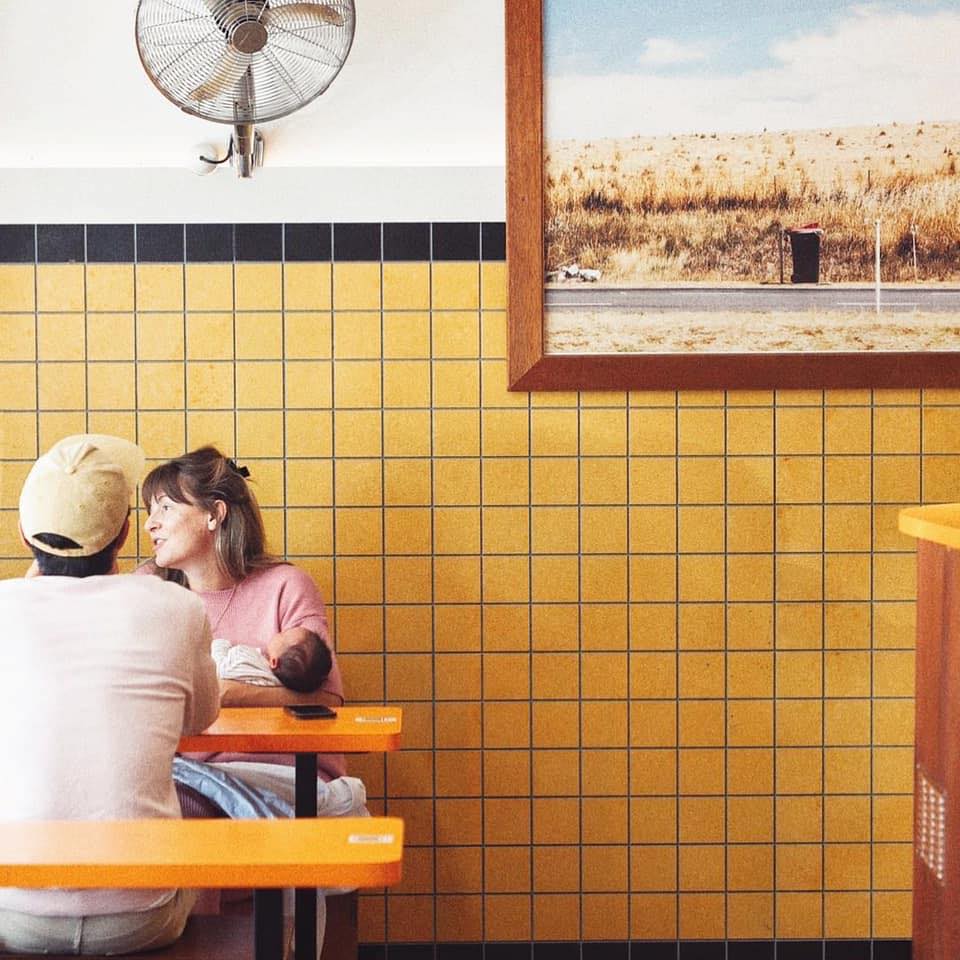
COFFEE | NATURAL WINES | CRAFT BEER | FOOD | SHIT MUSIC

Morning coffee should be ordered at Keith, a funky cafe-cum-bar situated in a ‘70s-era arcade. Owned and run by locals Matthew Taylor and Katie Browne, its stock in trade is carefully brewed coffee, sandwiches and sweet treats (with lots of gluten-free options) during the day, before it morphs into a cosy cocktail bar at night.
3
Uki

Open in mobile
Australia, 2484
Arrive via car from Uki15KM / 9MI ~ Approximately 14 minutes
Get Directions
Heading south out of Murwillumbah, the village of Uki (pronounced yook-eye) sits in the shadow of Wollumbin (Mount Warning) at the entrance to Wollumbin National Park ( FYI, the park is currently closed). Plan a visit to coincide with the Uki Buttery Bazaar Markets, held in the old buttery on the third Sunday of every month, or the local Farmers Market at the Uki Hall every Saturday morning.
4
Kyogle

town in New South Wales, Australia

Open in mobile
Credit: Elise Hassey
Australia, 2474
Arrive via car from Kyogle53KM / 33MI ~ Approximately an hour
Get Directions
From Uki, the road to the town of Kyogle is sandwiched between national parks dense with the rainforests that gives this drive its name. This area, part of the Bundjalung nation, is rich in Indigenous history and forms part of the World Heritage-listed Gondwana Rainforests of Australia, home to some of the oldest rainforest on Earth, dating back millions of years.
Nightcap National Park
Credit: Elise Hassey
Nightcap, NSW, Australia
Get Directions

In Nightcap National Park, the Mount Nardi to Mount Matheson loop trail is a three-kilometre walk through more verdant rainforest that rings the base of Mount Matheson, before gazing down into thick eucalyptus forest from a vertiginous cliff edge.While in Nightcap it is also worth the walk to Protesters Falls and Terania Creek, which anti-logging protesters managed to save from destruction in the late 1970s.
Mebbin National Park
Mebbin, NSW, Australia
Get Directions

The Byrril Creek walking track in Mebbin National Park meanders through subtropical rainforest and past ancient native fig trees (it’s a total of one-kilometre return).
5
Lismore

town in New South Wales, Australia

Open in mobile
Australia, 2480
Arrive via car from Lismore44KM / 27MI ~ Approximately 36 minutes
Get Directions
It’s another 50 minutes from Nightcap National Park to the regional city of Lismore. With the feel of a big country town, complete with gregarious, welcoming locals, Lismore has a buzzing food, arts and music scene that is worth taking the time to discover.Lismore Regional Gallery is a perfect example: one of the oldest art galleries in NSW (established in 1953, it houses works by the likes of Lloyd Rees, Albert Namatjira and Thea Proctor), it is now part of The Quad, a new culture and arts precinct that is also home to the Northern Rivers Conservatorium and the Richmond Tweed Regional Library.
Friends of the Koala Inc.
23 Rifle Range Road, Lismore, NSW, Australia, 2480
Get Directions

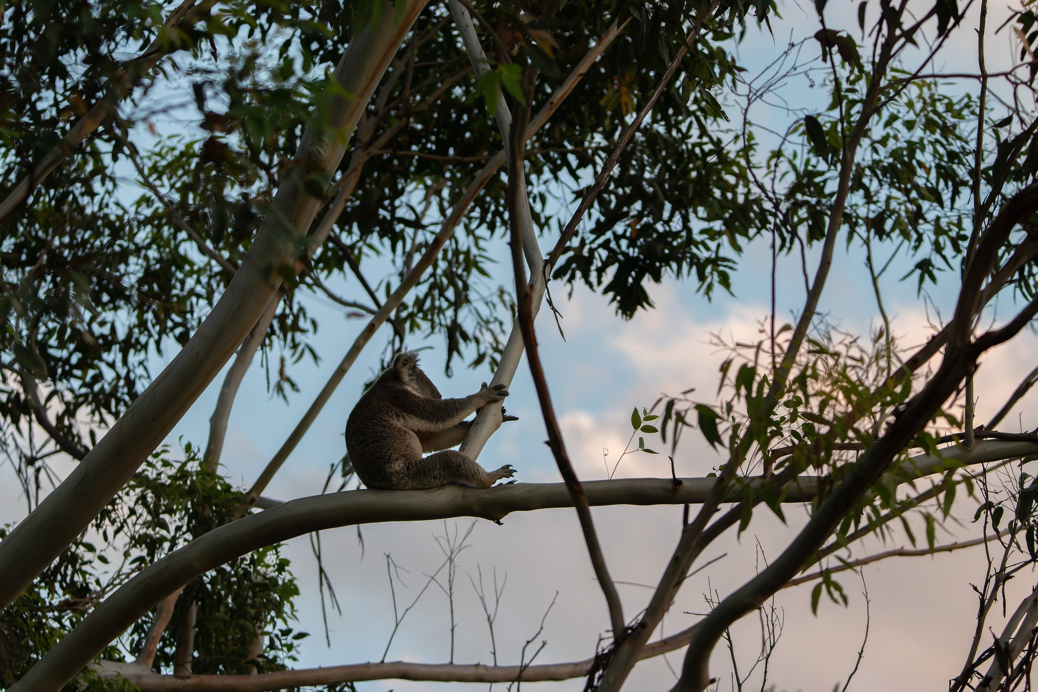
At Friends of the Koala, we believe in a future for koalas in the Northern Rivers region of NSW, Aust

Stop in at Friends of the Koalas’ Care Centre before leaving the city. Committed to protecting koalas and their habitat, especially in the Northern Rivers region, you can tour the centre, learn about the work done here and even catch a glimpse of some of the koalas in permanent care.
The Back Alley Gallery
Eggins Lane, Lismore, NSW, Australia, 2480
Get Directions

The Back Alley Gallery is an ongoing community street art project in Lismore (Northern NSW) with artw

The Back Alley Gallery program is also transforming the laneways of the city one large blank brick wall at a time. All up, there are more than 60 artworks – from giant murals to graffiti art to stencils – created by local and international artists now scattered across the city.
6
Casino

Open in mobile
Australia, 2470
Arrive via car from Casino31KM / 19MI ~ Approximately 25 minutes
Get Directions
After passing through the town of Casino, with its main street lined with Art Deco buildings, take a detour off the Buxner Highway into the Mallanganee National Park, created in 1999 and covering 1144 hectares, to stand in open-jawed wonder at the views from the Mallanganee Lookout. On a clear day looking out over Mallanganee Nature Reserve and Cambridge Plateau, you can see Wollumbin (Mount Warning) to the east and the Great Dividing Range to the west.
7
Tabulam

town in New South Wales, Australia

Open in mobile
Australia, 2469
Arrive via car from Tabulam56KM / 35MI ~ Approximately 37 minutes
Get Directions
The pretty historic town of Tabulam is the last official stop on the Rainforest Way. While it lays claim to being the location of the longest single-span truss timber bridge in Australia, it also provides easy access to two of the area’s most stunning national parks: Richmond Range and Tooloom.While Richmond Range National Park is laced with walking tracks, the 32-kilometre Cambridge Plateau scenic drive is the superstar here, tracing the ridge through ancient rainforest and providing views of the Richmond Valley below.

Sights & Activities

Tooloom National Park
Tooloom Road, Upper Tooloom, NSW, Australia, 2475
Get Directions

A great place for walking, picnicking, birdwatching and scenic views to the Great Dividing Range.

Tooloom National Park is teeming with wildlife – there are 10 different species of kangaroos and wallabies – and houses a number of significant Aboriginal cultural sites. Take the time to survey the area one last time as a panorama from Tooloom Lookout before heading back to the sun, sea, sand – and celebrities – of Byron Bay.

Using QR Codes

Open your Camera App or download a QR reader

Point your camera at the QR Code which will launch the correct app

Access websites and features such as maps and directions

Optional Downloads

GPX File

For use in apps such as GPS Navigation and wearable devices

KML File

For use in offline mapping products, such as maps.me and Google Maps

PDF File

A link to this document

Build your own itineraries

Alpaca provides a way for you to build your own itineraries. Visit https://alpaca.travel

Terms of Service and Attribution

Copyright Alpaca.travel, Mapbox.com and OpenStreetMaps openstreetmaps.com.
Terms of Service https://alpaca.travel/terms